
Fireside Chat: Open foundation models enabling a map of the planet
AI Openness: 3 Years on from Llama 2 Report
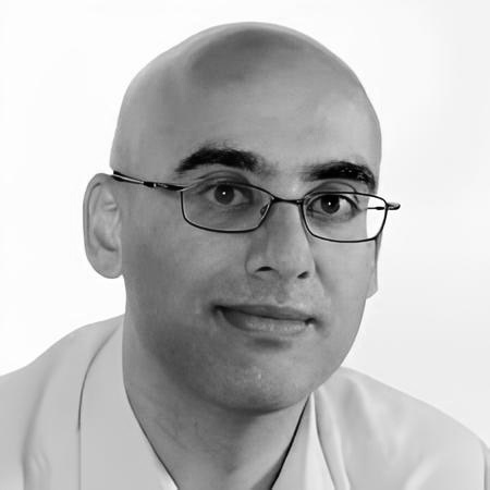
Professor Anil Madhavapeddy has shaped open source systems infrastructure for over two decades. He was part of the original Cambridge team that built the Xen hypervisor in 2002 – the first open source type-1 hypervisor, which went on to underpin the modern cloud – and has since worked on containerisation at Docker, the OCaml language and formal verification, and unikernels. Having trained in his early days at NASA, it is perhaps unsurprising that his current focus is planetary computing. He is a key member of the team at TESSERA, an open foundation model for the Earth’s terrestrial surface that releases its embeddings, weights and code openly for anyone to build on.
Can you explain what TESSERA is, how it is used, and why open source is so important to it?
TESSERA is an open foundation model for the entire terrestrial surface of the planet. It takes a year of multi-modal satellite time-series data – radar and optical imagery from missions such as the European Sentinel-1 and Sentinel-2 – and learns a compact seasonal “fingerprint” for every 10-metre patch of ground on Earth.
Those fingerprints can then be used very cheaply, often without a GPU, to carry out downstream geospatial tasks: finding crops, classifying land use, locating solar panels or waste dumps, even measuring forest density. We release the map embeddings globally and annually as CC0, alongside equally open weights and code, so anyone can build on them.
To use it, you download the fingerprints for your area of interest and train a lightweight model on top – for mapping crops, forests, flooding or habitats – using a handful of labels rather than millions. We have seen state-of-the-art accuracy across very different mapping tasks from the same embeddings, so we place a lot of trust in them being accurate.
Openness matters here because a foundation model of the planet that you cannot inspect, cannot reproduce, and cannot train yourself would be a dangerous thing to derive social land-use policy from. The people who need it most – conservationists, smallholder farmers, government agencies across the Global South – are the least likely to be able to pay big money for proprietary access.
And could you share the hedgehog example our CEO loves?
As a fun but important example, we recently used TESSERA to help understand why Britain’s favourite mammal is quietly disappearing. Hedgehogs are now classed as vulnerable to extinction, and rural populations are crashing. With my colleagues Silviu Petrovan, Sadiq Jaffer, Lauren Moore and David Coomes, we are mapping the habitats a hedgehog actually cares about – the “scruffy land” of brambles, hedgerows, and the scrubby green corridors between gardens. Silviu coined the term “digihog”, because we are also
using GPS-tagged hedgehogs to train models of how they move, so we can predict where habitat
preservation is most needed.
TESSERA uses Barlow Twins. How does that connect to Yann LeCun’s argument that LLMs are a dead end and self-supervised methods are the future?
The bet in self-supervised learning is that you learn the structure of the world from raw, unlabelled observations rather than from human annotation. That is a perfect fit for satellite data, because the planet pours petabytes of unlabelled imagery down at us every day, and it is enormously expensive to label all of it by hand. With self-supervised methods like Barlow Twins, we never tell TESSERA what a forest or a flood is; it learns a representation of the planet’s surface from the raw signal, and we only add human labels at the very end, for the specific task at hand. Barlow Twins, JEPA, LeJEPA and their many variants are all particularly good at building “world models” for physical environments, which is exactly what our geospatial work needs.
Yann argued at the Indian AI summit that the fair way to build open models is for each country to contribute its own data and federate them into one shared model. That may be too late for language models, but it is well suited to satellite data: we already have a public global baseline through Landsat (NASA) and Sentinel (EU), and many countries fly their own higher-resolution task satellites over their own territory. So TESSERA may be the ideal place to actually trial his idea of a global training cooperative, because the incentives line up in a way they simply don’t for frontier LLMs.
Claude Fable was used as part of TESSERA. Why was it cut off, in your view, and what has the impact been?
The practical impact is that I am now forced to be reactive rather than proactive.
I maintain a number of open source projects – OCaml, Docker and others – and I receive a steady stream of reported security vulnerabilities against them. It is incredibly frustrating not to be able to run my own scans. Losing access means I have to wait and react to vulnerabilities as they come in, rather than proactively scanning for them myself.
Could this moment be considered a positive turning point?
It can be. Open source is the one form of technology transfer that doesn’t require trusting the supplier indefinitely, and that is an enormous advantage when alliances are as fluid as they seem to be these days. The tension is that open source is inherently a global commons. I don’t think we resolve that by pretending the borders aren’t there; we resolve it by building neutral, shared infrastructure that is valuable enough to everyone that no single nation wants to break it – like the Internet itself. A planetary dataset is a good candidate for exactly that: nobody owns the weather, and everybody needs reliable maps.
What is the replacement, and why DeepSeek specifically? Was there a cost saving or any loss of quality – and does swapping a US proprietary model for a Chinese open one just trade one dependency for another?
DeepSeek is still very expensive to run locally, though the cost of local inference is dropping every day. We had to spend quite a bit of cash to get it working at all, so losing access to hosted models is not ideal in the short term.
And yes, in the long run it does trade one dependency for another. That is precisely why we must ultimately have sovereign models built on open training data – otherwise we are always at the mercy of a supplier. It comes back to the case for open source itself.
Is US policy inadvertently pushing the world towards open source, and towards China’s products? Are you inclined to choose non-US commercial technology?
We are “anti-lock-in” more than we hold any geopolitical stance.
As Mark Carney recently noted in his Davos speech, “Middle powers must act together because if we’re not at the table, we’re on the menu.”
Those middle powers include much of the world’s Global South, who desperately need every data tool they can get in order to embark on climate adaptation for their populations. Everything we can do to keep TESSERA open is vital to that adoption.
Do you expect your story, and others’ experience, to drive more technologists to build on open source – and will that extend to end users?
Every hackathon we have run has been filled to capacity, and our GitHub issues are overflowing with requests. That is simply because building on an open foundation model like TESSERA is the faster, cheaper way to get to a working result, and once a generation of geospatial engineers has tasted that, they don’t go back to proprietary tools. Why would they take on all the extra hassle?
The risk we have to manage is community, not adoption. When everyone is coding with AI assistance at high speed, we have to work much harder to keep people talking to each other – mentoring, trading tips of the craft, making sure they actually understand how it all works. Our end users will benefit from the vastly cheaper and more flexible geospatial tasks that TESSERA enables, and that benefit extends to open source use of it too.
What first drew you to open source, and why has it stayed central to your work for over two decades? Has your reason changed?
I was on the original Cambridge team that built the Xen hypervisor back in 2002 – the first open-source type-1 hypervisor, which ended up underpinning the modern cloud. What drew me in was entirely selfish at first: open source was simply the most fun way to learn how the Internet worked. I got started on OpenBSD and PHP contributions in the late 90s, and you could hack on any part of it. It stayed central because I turned that early hacking into a career – in systems infrastructure like Docker, in formal verification with OCaml, and in novel operating systems with unikernels. Nothing proprietary I have worked on has had anything like that reach or longevity.
My reason has changed over the years. In the early days it was about fun and accessibility. In the middle years, around Docker, it became more of a corporate experience – not necessarily worse, because people get paid now. But more recently, working on the planet’s climate and biodiversity crisis has turned my position into an ethical one: we must ensure that the poorest people in the world can use open source as a leapfrogging technology to equitably improve their own lives.
In simple terms, what is TESSERA, and what problem does it solve?
TESSERA is a free, open “map-maker” for the whole planet. The problem it solves is that understanding the Earth from satellites used to require a supercomputer, vast storage, and a small army of experts to label imagery by hand. TESSERA does the expensive part once, for everyone, and hands users a ready-made “seasonal fingerprint” of every patch of ground on Earth. After that, answering a huge variety of questions – where the forests are, where the floods will hit, where the hedgehogs live, whatever you can observe from space – becomes about as easy as ordinary programming. And with open coding models now available, that means just about anyone can have a go.
First published by OpenUK in 2026 as part of AI Openness: 3 Years on from Llama 2
©OpenUK2026 
Download Thought Leadership Download Report View all thought leadership